THE FIRST RULE FOR YOUR MISSION SUCCESS IS FOR YOU TO HAVE A CLEAR VISION.

What do you want to achieve?

Once you know what you want to achieve, then the only question left is, “How?” How do you create the vision? Then, how do you take that vision into reality? AED Aero is here to take care of the “How?” for all of your GIS Data, Cartography, and Mapping needs.

GIS DATA MANAGEMENT PROVIDES

Increased Customer Care

Increased
Safety

Increased Operational Efficiency

Increased Profitability

All
Cartography
GIS
Support
Website image 16 (Aviation GIS & Custom Cartography)

Aviation GIS & Custom Cartography

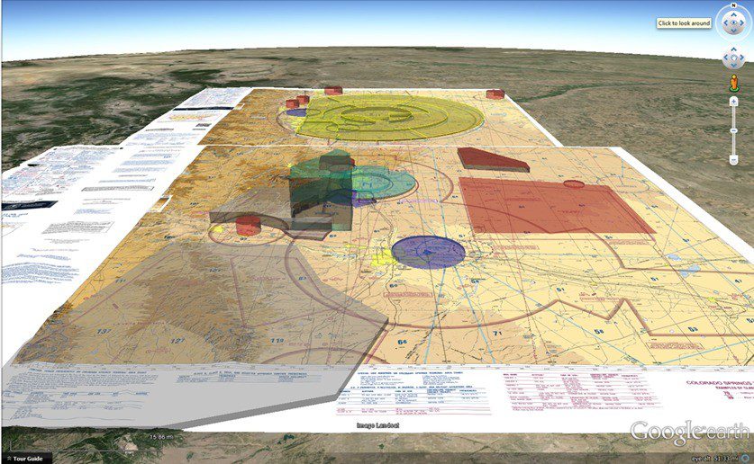
We offer the most advanced and detailed aviation charts in the world. Fully aligned to the civilian International Civil Aviation Organization (ICAO) Annex 4 specification, our AED AeroCharts brand is designed to meet every mission need. From Search And Rescue (SAR) to fighting forest fires, each mission requires cartography charting products designed to ensure your mission is a success. If you are using NGA products, did you know that you are paying for scanned copies of paper charts that expired over half a century ago. You don't fly your Grandfathers airplane, why are you still using his charts! Depending on the customer, we can also produce a full range of civilian charts; as well as military charts on a case by case basis. Are you ready to have the latest in aviation mapping technology in your aircraft or mission planner?

Airport GIS

Airport GIS

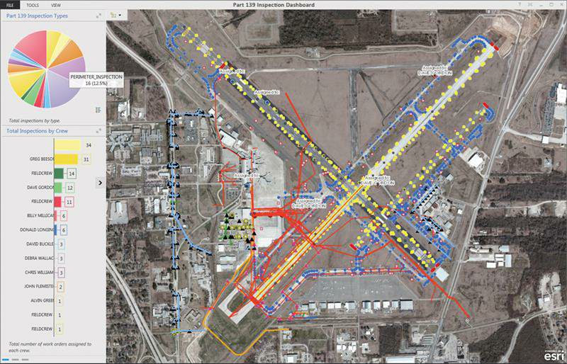
Put our GIS expertise to work for your Airport. With aviation cartography, we can create custom aviation map products; airfield diagrams; airfield operational analysis; arrival, departure, and ground operations safety of flight GIS analysis; airfield surveying/scanning; civil engineering and cost estimating. Are you ready to make your airport more efficient while increasing safety? Only trust AED Aero to be a key part of your airport management program.

Infrastructure Management

Infrastructure Management

To provide the most cost effective and streamlined GIS capabilities possible for city management, AED Aero is proud of our affiliation with CityWorks and the exceptional capabilities we can now offer. AED Aero can now provide a unique capability which enables the management of the airspace above a city all the way to the underground utilities. All in one system. This enables officials to critically look at all aspects of management; from hospitals and medivac helicopter corridors, to utilities and telecommunications. The GIS experts at AED Aero are the key to your success in the operations, safety, and profitability throughout all aspects of city management.

StMarysHosp1

GIS for Hospitals & Healthcare Administration

Your needs are unique, so why are you settling on old and obsolete data products that do not meet all of your healthcare industry needs? In today's world you need the latest in technology in order to maintain your healthcare industry competitive advantage. Use our advanced Esri based Hospital and Healthcare GIS technology to understand your community and identify the healthcare services your patients need. With smart maps and spatial analysis, you can optimize your mix of healthcare services and find the best places to locate health facilities and reduce cost, while providing geographically optimized patient care. Your healthcare operation demands the latest in technology, are you ready to make the switch to AED Aero?

File Conversion-Ipad

File Conversion - CADRG, GeoTIFF, ASRP

With a revolutionary approach to Compressed Arc Digital Raster Graphics (CADRG) file conversion producing near GeoTIFF image quality, to the production of GeoTiff, ASRP, WebMap, .kml, and .kmz files for use in a huge number of applications. From electronic kneeboards, mission planners, operations centers, to on aircraft moving map systems, all have a unique file format. AED Aero is able to convert our GIS products into nearly any file format you may need for your given application. Some platforms require extremely specialized file format, which can be exceptionally hard to procure. In all instances, AED Aero is here to help you meet your mission needs. Do you have a moving map or database challenge?

Telecommunications

Telecommunications

Your customer experience is directly related to your profitability. AED Aero offers network planning to enable multiple different factors to be considered when selecting the most appropriate network technology and cell site locations. We can take into account multiple factors through the planning, design, and sustainment process. AED Aero is the right company to manage your telecommunications GIS Infrastructure.

Website image 15

Visualization & 3D GIS

3D visualization is an important capability for you to have. It enables you to see the terrain, obstacles, man-made infrastructure, and other critical aspects of your operational area from all perspectives. In aviation, it will allow you to see your route of flight in advance. In wind or solar applications, it will allow you to more accurately determine optimal system placement for better returns on investment. In military applications it will allow you to visualize threats and develop better tactics. In all instances, 3D is an integral part to better operations for your organization.

GIS-sea-ocean-sky-night-cosmos-view-826635-pxhere.com

Aerial Survey

Starting in 2019, AED Aero has expanded into aerial surveying. Our unique use of our unique heavy equipment aircraft allows us to carry modular survey payload up to 1,100 pounds (498 kg) with no loss in aircraft performance or safety. Through our modular payload system we can operate a wide variety of survey sensors ranging from one, two, or three LiDAR systems operating simultaneously in combination with other camera systems. Starting in 2021 we will be expanding our survey system capability by adding a modular IfSAR capability to our survey mission payload. AED Aero is the only aerial survey company with a modular payload capability. This reduces cost and increased mission flexibility for gathering your data needs.

Load More